

View Information About HSR Ratings
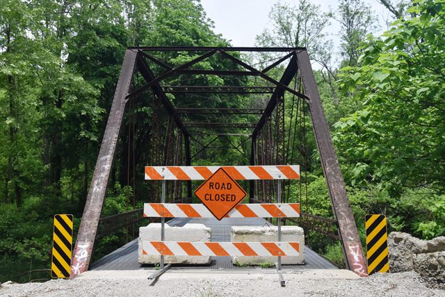
This is a traditional early 20th century pin connected truss bridge. The bridge has been closed to traffic.
Information and Findings From DHPA Historic Bridge SurveyBridge History and Significance Original Location: S13/18 - T1S - R1W/1E - (1905 - 1926) The commissioners spent the day "locating a bridge site" near the line dividing Southeast and Greenfield townships on 10 June 1905. In early July, the board adopted plans and specifications for the Dicy White Ford Bridge across the Patoka River and ordered bidding. The county received nearly a dozen proposals in August and awarded a contract to the Vincennnes Bridge Company which brought in the lowest bid at $1,737.50 for the complete structure, including a "90-foot by 14-foot High Truss" steel superstructure. Lynden B. White was appointed superintendent of construction. In September 1906, the commissioners noted that the need to shift the proposed location of the Dicy White Ford Bridge had required some transfer of land to the county, but the bridge was now in process of construction at the somewhat relocated site. White certified satisfactory and complete construction by early November. The board viewed the bridge and agreed to pay the contract amount plus $240 extra for the stone abutments. In 1921, the state surveyed the Paoli to English Road for inclusion in the state highway system, including the Dicy White Ford Bridge over the Patoka. In 1923, the state surveyed the bridge site in preparation for a longer and wider replacement structure raised higher to allow for more waterway clearance. The surveyors noted the old structure was "in need of cleaning and painting and believe will last for a year or so." In 1926, the state erected three 72-foot pony-truss spans here with a 19-foot and 2-inch roadway. Surveyed Location - (1926/27 - present) In turn, Orange county returned their old but still functional Dicy White Ford structure to the county roadway system and re-erected it on new concrete abutments and wingwalls. A pair of laced channels provides each intermediate truss vertical, a pair of die-forged eyebars serves as each diagonal set, and a pair of cylindrical rods with turnbuckles counter the diagonals in the most central panel. The I floor-beams are U-bolted to the lower pins. The bridge carries a timber deck and allows 13-feet and 10-inches of vertical clearance over the roadway. These once-moved, pinned Pratt through trusses are conventionally designed. The original truss members function in their current locale and are given a small decorative touch by vintage latticed guardrails. References Warren T. Hobson & Associates, Bridge Inspection/Reinspection Report: Orange County (Indianapolis, 1974, 1979, 1996). Indiana State Highway Commission, Road Survey, 198: 2; Bridge Survey, 86: 34-39; 2204: 2-3. Orange County, "Commissioners Record," 15: 67, 86, 118-120, 419-421, 467. "English and Paoli Road Now Open," The Paoli News, 10 November 1926: p1c2. Bridge Considered Historic By Survey: Yes |
![]()
![]()
![]()
Coordinates (Latitude, Longitude):
Search For Additional Bridge Listings:
Bridgehunter.com: View listed bridges within 0.5 miles (0.8 kilometers) of this bridge.
Bridgehunter.com: View listed bridges within 10 miles (16 kilometers) of this bridge.
Additional Maps:
Google Streetview (If Available)
GeoHack (Additional Links and Coordinates)
Apple Maps (Via DuckDuckGo Search)
Apple Maps (Apple devices only)
Android: Open Location In Your Map or GPS App
Flickr Gallery (Find Nearby Photos)
Wikimedia Commons (Find Nearby Photos)
Directions Via Sygic For Android
Directions Via Sygic For iOS and Android Dolphin Browser
USGS National Map (United States Only)
Historical USGS Topo Maps (United States Only)
Historic Aerials (United States Only)
CalTopo Maps (United States Only)

© Copyright 2003-2024, HistoricBridges.org. All Rights Reserved. Disclaimer: HistoricBridges.org is a volunteer group of private citizens. HistoricBridges.org is NOT a government agency, does not represent or work with any governmental agencies, nor is it in any way associated with any government agency or any non-profit organization. While we strive for accuracy in our factual content, HistoricBridges.org offers no guarantee of accuracy. Information is provided "as is" without warranty of any kind, either expressed or implied. Information could include technical inaccuracies or errors of omission. Opinions and commentary are the opinions of the respective HistoricBridges.org member who made them and do not necessarily represent the views of anyone else, including any outside photographers whose images may appear on the page in which the commentary appears. HistoricBridges.org does not bear any responsibility for any consequences resulting from the use of this or any other HistoricBridges.org information. Owners and users of bridges have the responsibility of correctly following all applicable laws, rules, and regulations, regardless of any HistoricBridges.org information.
![]()