

View Information About HSR Ratings

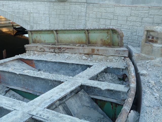
HistoricBridges.org intended to photo-document this historic bridge as part of a June 2012 visit to Maine. However all that remained of this bridge was about a quarter of the bridge. The rest of the bridge had already been cut up and hauled away as scrap metal. HistoricBridges.org is still featuring a webpage for this bridge with photos of what was left to the bridge for a simple reason: to demonstrate the risk that historic bridges in Maine face. Very few of Maine's historic bridges have been preserved. Particularly at risk are movable, metal truss, and concrete rainbow arch bridges due to the limited numbers remaining in the state. More than just history was destroyed with this bridge's replacement, function was also lost. This bridge was replaced with a fixed span that does not offer very much vertical clearance. The Songo River Queen II cannot fit under the replacement bridge and is now forever confined to a limited section of the waterway. Only small pleasure craft can now navigate the waterway. Opportunities to preserve the historic bridge, even with the bridge replacement were not considered. At the very least, the bridge could have been left in the open position as a non-functional exhibit, or even moved to a new location as a non-functional exhibit.
![]()
![]()
![]()
This historic bridge has been demolished. This map is shown for reference purposes only.
Coordinates (Latitude, Longitude):
Search For Additional Bridge Listings:
Bridgehunter.com: View listed bridges within 0.5 miles (0.8 kilometers) of this bridge.
Bridgehunter.com: View listed bridges within 10 miles (16 kilometers) of this bridge.
Additional Maps:
Google Streetview (If Available)
GeoHack (Additional Links and Coordinates)
Apple Maps (Via DuckDuckGo Search)
Apple Maps (Apple devices only)
Android: Open Location In Your Map or GPS App
Flickr Gallery (Find Nearby Photos)
Wikimedia Commons (Find Nearby Photos)
Directions Via Sygic For Android
Directions Via Sygic For iOS and Android Dolphin Browser
USGS National Map (United States Only)
Historical USGS Topo Maps (United States Only)
Historic Aerials (United States Only)
CalTopo Maps (United States Only)

© Copyright 2003-2024, HistoricBridges.org. All Rights Reserved. Disclaimer: HistoricBridges.org is a volunteer group of private citizens. HistoricBridges.org is NOT a government agency, does not represent or work with any governmental agencies, nor is it in any way associated with any government agency or any non-profit organization. While we strive for accuracy in our factual content, HistoricBridges.org offers no guarantee of accuracy. Information is provided "as is" without warranty of any kind, either expressed or implied. Information could include technical inaccuracies or errors of omission. Opinions and commentary are the opinions of the respective HistoricBridges.org member who made them and do not necessarily represent the views of anyone else, including any outside photographers whose images may appear on the page in which the commentary appears. HistoricBridges.org does not bear any responsibility for any consequences resulting from the use of this or any other HistoricBridges.org information. Owners and users of bridges have the responsibility of correctly following all applicable laws, rules, and regulations, regardless of any HistoricBridges.org information.
![]()