

View Information About HSR Ratings
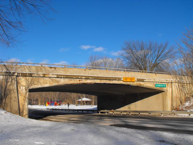
This bridge is one of a number of concrete rigid-frame bridges that cross rivers and roads over and on Hines Drive as well as on some of the other roads that run through the River Rouge parkways. They were designed by the Wayne County Road Commission, and are somewhat of an anomaly in Michigan. Elsewhere in the state, other counties as well as the Michigan State Highway Department never appear to have built rigid-frame bridges very frequently, so few remain today. As such, the group of rigid-frame bridges along River Rouge stand out in Michigan as something unusual. Among the rigid-frame bridges remaining on Hines Driver and the River Rouge, this one stands out as one of the three earliest surviving examples. All the other examples date to 1947 or later, making these three earlier examples quite a bit older and thus more significant. Like most of the old bridges along the River Rouge parkways, this bridge has unfortunately lost its original railings. This bridge on Plymouth Road has architectural detailing on the abutments that is very similar to the architectural details seen on some of the concrete arch bridges that the county built during this period, such as the nearby River Rouge Bridge located almost immediately east of this bridge.
This bridge was formally found eligible for listing in the National Register of Historic Places by Michigan Department of Transportation during a 2007 update of the Historic Bridge Inventory.
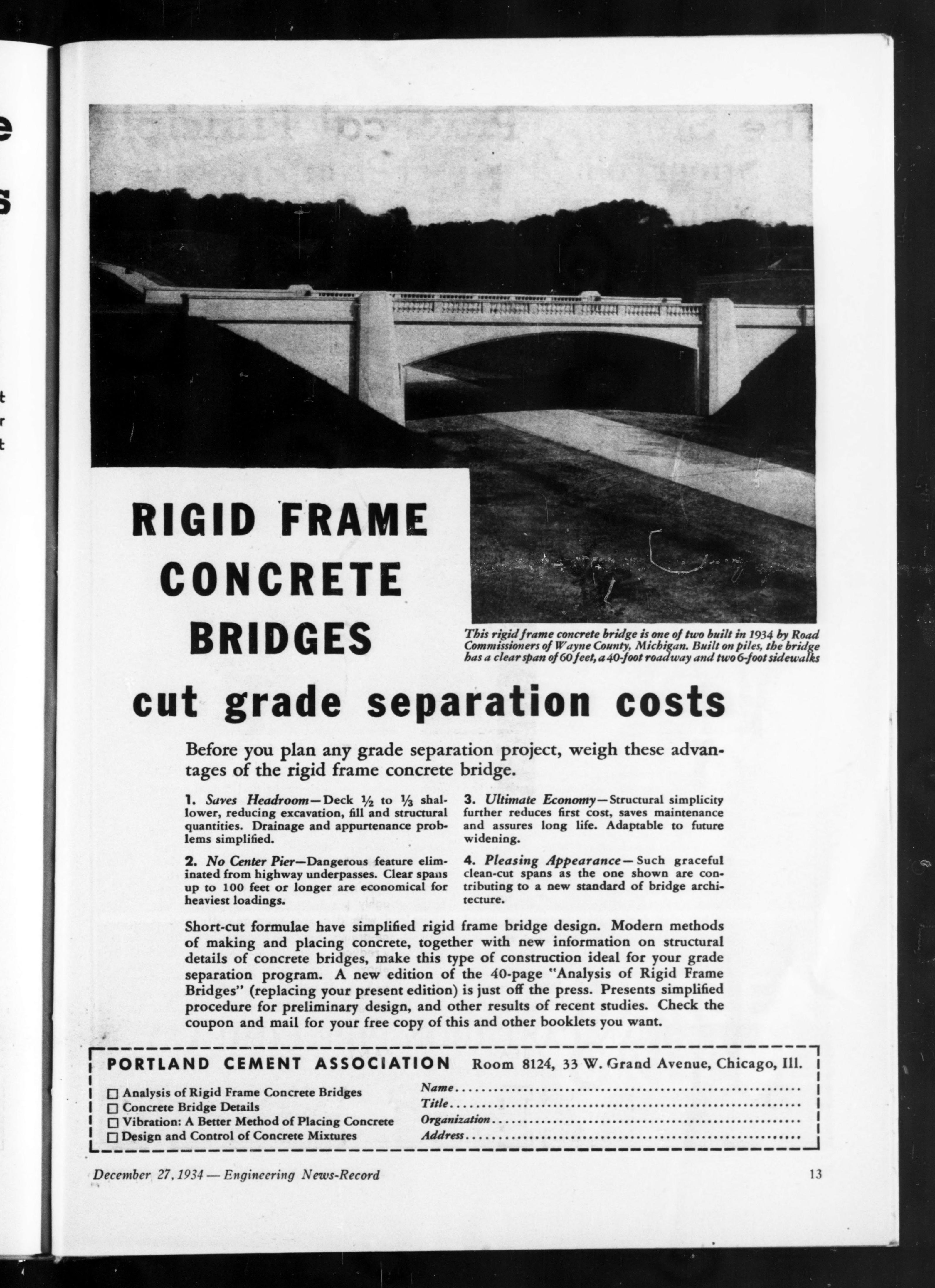
Above: 1934 advertisement for another rigid-frame bridge built in this same year by Wayne County.
![]()
![]()
![]()
Coordinates (Latitude, Longitude):
Search For Additional Bridge Listings:
Bridgehunter.com: View listed bridges within 0.5 miles (0.8 kilometers) of this bridge.
Bridgehunter.com: View listed bridges within 10 miles (16 kilometers) of this bridge.
Additional Maps:
Google Streetview (If Available)
GeoHack (Additional Links and Coordinates)
Apple Maps (Via DuckDuckGo Search)
Apple Maps (Apple devices only)
Android: Open Location In Your Map or GPS App
Flickr Gallery (Find Nearby Photos)
Wikimedia Commons (Find Nearby Photos)
Directions Via Sygic For Android
Directions Via Sygic For iOS and Android Dolphin Browser
USGS National Map (United States Only)
Historical USGS Topo Maps (United States Only)
Historic Aerials (United States Only)
CalTopo Maps (United States Only)

© Copyright 2003-2024, HistoricBridges.org. All Rights Reserved. Disclaimer: HistoricBridges.org is a volunteer group of private citizens. HistoricBridges.org is NOT a government agency, does not represent or work with any governmental agencies, nor is it in any way associated with any government agency or any non-profit organization. While we strive for accuracy in our factual content, HistoricBridges.org offers no guarantee of accuracy. Information is provided "as is" without warranty of any kind, either expressed or implied. Information could include technical inaccuracies or errors of omission. Opinions and commentary are the opinions of the respective HistoricBridges.org member who made them and do not necessarily represent the views of anyone else, including any outside photographers whose images may appear on the page in which the commentary appears. HistoricBridges.org does not bear any responsibility for any consequences resulting from the use of this or any other HistoricBridges.org information. Owners and users of bridges have the responsibility of correctly following all applicable laws, rules, and regulations, regardless of any HistoricBridges.org information.
![]()