HistoricBridges.org Menu: HistoricBridges.org Menu:


We Recommend:
Bach Steel - Experts at historic truss bridge restoration.

HistoricBridges.org: Bridge Browser

Old US-41 Pike River Bridge

Trunk Line Bridge Number 8

Old US-41 Pike River Bridge

Primary Photographer(s): Nathan Holth

Bridge Documented: October 1, 2012

View Photos
and Videos
View Maps
and Links

Facility Carried / Feature Intersected
Old US-41 (CR-C117) Over Pike River
Location
Rural: Houghton County, Michigan: United States
Construction Date and Builder / Engineer
1914 By Builder/Contractor: Smith-Byers-Sparks Company of Houghton, Michigan and Engineer/Design: Michigan State Highway Department
Rehabilitation Date
1966
Main Span Length
36.7 Feet (11.2 Meters)
Structure Length
37.7 Feet (11.5 Meters)
Roadway Width
19 Feet (5.79 Meters)
Spans
1 Main Span(s)
Inventory Number
3425

Historic Significance Rating (HSR)
View Information About HSR Ratings

Bridge Documentation

View Archived National Bridge Inventory Report - Has Additional Details and Evaluation

This bridge is one of the first state highway bridges ever built in Michigan, in fact the 8th bridge authorized to be built under the 1913 State Trunk Line Act. This is why the bridge was designated Trunk Line Bridge #8. The bridge is significant as one of the first such bridges built. The bridge is not structurally rare or unusual; it is a steel stringer bridge. However, it is an early and unaltered example of this bridge type in Michigan. The bridge has been closed to traffic. It appears to have abutment problems at the northwestern end, with a large crack in the abutment wall visible. The superstructure is in overall decent condition.

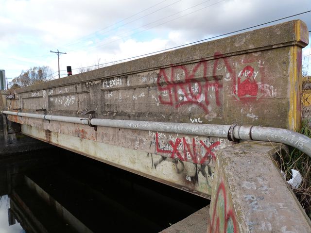
Information and Findings From Michigan Historic Bridge Inventory

Narrative Description

Located in Chassell Township, this small-scale concrete/steel bridge spans the Pike River on County Road C117. The crossing is situated immediately south of the village of Chassell, near the river's mouth at Pike Bay. The structure is configured as a 38-foot, steel stringer span, with five lines of rolled I-beams supported simply by concrete abutments. Architectural expression is provided by MSHD standard paneled concrete guardrails. Cast into the guardrails are "State Trunk Line Bridge 1914" on one side and "Built by S-B-S Co Houghton" on the other. In unaltered and excellent structural condition, the Pike River Bridge has retained a high degree of physical integrity.

Soon after the legislature passed the State Trunk Line Act in 1913, authorizing the formation of a trunk line system of roads, a north-south route across the western end of the Upper Peninsula began to coalesce. Designated across Keweenaw, Houghton, Ontonagon and Gogebic counties, it linked the major east-west trunk line across Peninsula with the Peninsula's extreme northern tip at the Keweenaw Peninsula. By 1915 the route was virtually complete. Two of the bridges built with the initial construction of the trunk line were identical concrete/steel structures over the Pike and Snake rivers near Chassell. For these crossings, the Michigan State Highway Department delineated 38-foot steel stringer structures, designating the Trunk Line Bridges Nos. 8 and 9, respectively. In 1913 MSHD awarded the contract to build the two bridges to the Smith-Byers-Sparks Company. The Houghton-based contractors used steel stringers fabricated by the Jarvis Engine and Machine Works of Lansing to complete them in 1914. The trunk line route was incorporated into US-41 in the 1920s. The Snake River Bridge was later replaced in 1934 but the Pike River Bridge has been bypassed by the highway. It now carries local traffic in essentially unaltered condition.

The steel stringer configuration of the Pike River Bridge was one of the earliest standard designs developed by the state highway department. First delineated in the 1905-1906 biennium, it used relatively shallow I-beams in a relatively short-span configuration. The department used steel stringer bridges intermittently in the 1910s depending largely upon the price and availability of rolled I-beams. The Pike River Bridge is distinguished as one of the first trunk line bridges to use the steel stringer configuration. Of the 22 trunk line bridges listed in MSHD's 1913-1914 biennial report, almost half are stringer bridges. All but the Pike River Bridge have subsequently been demolished or altered. This bridge is this significant for its representation of this important structural type, and it is important as an early, unaltered remnant of the upper Peninsula's trunk line system.

Divider

Photo Galleries and Videos: Old US-41 Pike River Bridge


View Photo Gallery

Bridge Photo-Documentation

Original / Full Size Photos
A collection of overview and detail photos. This gallery offers photos in the highest available resolution and file size in a touch-friendly popup viewer.
Alternatively, Browse Without Using Viewer

Divider

View Photo Gallery

Bridge Photo-Documentation

Mobile Optimized Photos
A collection of overview and detail photos. This gallery features data-friendly, fast-loading photos in a touch-friendly popup viewer.
Alternatively, Browse Without Using Viewer

Divider

Maps and Links: Old US-41 Pike River Bridge

Coordinates (Latitude, Longitude):

Search For Additional Bridge Listings:

Bridgehunter.com: View listed bridges within 0.5 miles (0.8 kilometers) of this bridge.

Bridgehunter.com: View listed bridges within 10 miles (16 kilometers) of this bridge.

HistoricBridges.org Bridge Browser: View listed bridges within 0.5 miles (0.8 kilometers) of this bridge.

HistoricBridges.org Bridge Browser: View listed bridges within 10 miles (16 kilometers) of this bridge.

2021 National Bridge Inventory: View listed bridges within 0.5 miles (0.8 kilometers) of this bridge.

Additional Maps:

Google Maps

Google Streetview (If Available)

Bing Maps

OpenStreetMap

GeoHack (Additional Links and Coordinates)

Apple Maps (Via DuckDuckGo Search)

Apple Maps (Apple devices only)

MapQuest

HERE We Go Maps

ACME Mapper

Waze Map

Android: Open Location In Your Map or GPS App

Flickr Gallery (Find Nearby Photos)

Wikimedia Commons (Find Nearby Photos)

Directions Via Sygic For Android

Directions Via Sygic For iOS and Android Dolphin Browser

USGS National Map (United States Only)

Historical USGS Topo Maps (United States Only)

Historic Aerials (United States Only)

CalTopo Maps (United States Only)


Divider
 
Home Top

Divider

About - Contact

© Copyright 2003-2024, HistoricBridges.org. All Rights Reserved. Disclaimer: HistoricBridges.org is a volunteer group of private citizens. HistoricBridges.org is NOT a government agency, does not represent or work with any governmental agencies, nor is it in any way associated with any government agency or any non-profit organization. While we strive for accuracy in our factual content, HistoricBridges.org offers no guarantee of accuracy. Information is provided "as is" without warranty of any kind, either expressed or implied. Information could include technical inaccuracies or errors of omission. Opinions and commentary are the opinions of the respective HistoricBridges.org member who made them and do not necessarily represent the views of anyone else, including any outside photographers whose images may appear on the page in which the commentary appears. HistoricBridges.org does not bear any responsibility for any consequences resulting from the use of this or any other HistoricBridges.org information. Owners and users of bridges have the responsibility of correctly following all applicable laws, rules, and regulations, regardless of any HistoricBridges.org information.

Admin Login

Divider