

View Information About HSR Ratings
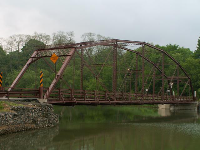
This is a traditional example of an uncommon truss configuration, the Pennsylvania truss. The structure was built by the Owego Bridge Company, a locally prolific bridge company. The structure features twelve panels, and decorative treatment on top of the portal bracing. The bridge was repaired in 1992, and this is most likely when a number of alterations were made to the structure. Some of the lower sections of the vertical members and end posts were replaced. In these locations, modern repair methods were used, including bolts and welds. Bolts were used elsewhere to replace select rivets as well. These repairs do not represent the most sophisticated restoration work, and as such the historic integrity has suffered to some extent. The overall structure remains intact however, and most casual viewers will continue to experience full enjoyment of this important bridge.
The existence of other Pennsylvania truss bridges with better integrity elsewhere in the country holds back this bridge's national significance. However the bridge is quite rare for this area, and as such retains a higher level of local significance.
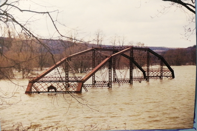
Above: Bridge in April 13, 2002 flood. Photo Credit: Trish Kane.
This bridge is tagged with the following special condition(s): Unorganized Photos
![]()
![]()
![]()
![]()
Coordinates (Latitude, Longitude):
Search For Additional Bridge Listings:
Bridgehunter.com: View listed bridges within 0.5 miles (0.8 kilometers) of this bridge.
Bridgehunter.com: View listed bridges within 10 miles (16 kilometers) of this bridge.
Additional Maps:
Google Streetview (If Available)
GeoHack (Additional Links and Coordinates)
Apple Maps (Via DuckDuckGo Search)
Apple Maps (Apple devices only)
Android: Open Location In Your Map or GPS App
Flickr Gallery (Find Nearby Photos)
Wikimedia Commons (Find Nearby Photos)
Directions Via Sygic For Android
Directions Via Sygic For iOS and Android Dolphin Browser
USGS National Map (United States Only)
Historical USGS Topo Maps (United States Only)
Historic Aerials (United States Only)
CalTopo Maps (United States Only)

© Copyright 2003-2024, HistoricBridges.org. All Rights Reserved. Disclaimer: HistoricBridges.org is a volunteer group of private citizens. HistoricBridges.org is NOT a government agency, does not represent or work with any governmental agencies, nor is it in any way associated with any government agency or any non-profit organization. While we strive for accuracy in our factual content, HistoricBridges.org offers no guarantee of accuracy. Information is provided "as is" without warranty of any kind, either expressed or implied. Information could include technical inaccuracies or errors of omission. Opinions and commentary are the opinions of the respective HistoricBridges.org member who made them and do not necessarily represent the views of anyone else, including any outside photographers whose images may appear on the page in which the commentary appears. HistoricBridges.org does not bear any responsibility for any consequences resulting from the use of this or any other HistoricBridges.org information. Owners and users of bridges have the responsibility of correctly following all applicable laws, rules, and regulations, regardless of any HistoricBridges.org information.
![]()