

View Information About HSR Ratings
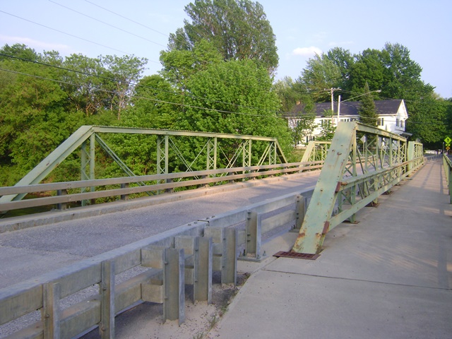
This excellent and rare multi-span pony truss built by the noteworthy Groton Bridge Company, and its trusses were converted to decorative, a compromise preservation solution that has been nicely implemented here. Turning a truss bridge into non-structural elements of a replacement bridge is a way to retain a historic truss while avoiding unsightly alterations needed to bring it up to legal load limits, and with pony truss bridges it also allows for the deck to be widened without alterations to the truss lines themselves. There are both good and bay ways to approach this type of alteration to a historic truss, this one presents a couple best practices including avoiding encasement of the trusses in concrete, and "stubbing" the floorbeams into the steel stringers (rather than removing the floorbeams completely) which in this case was critical because the floorbeams were historically signifciant built-up fishbelly floorbeams and this is still apparant given the stubbing process.
Note that the railings, although attractive, were not original to the truss bridge. The loss of original sidewalk railings is the only major unfortunate loss on the bridge.
The bridge is located in a National Register Historic District, likely accounting for the trusses being spared a visit to the dumpster.
Please note that the dimensions given are for the truss bridge prior to alteration. Please download the National Bridge Inventory sheet which includes both the pre and post alteration sheets (and associated dimensions), although note the pre-alteration NBI sheet shows the bridge as four spans, perhaps indicative that the bridge had added supports prior to the alteration project.
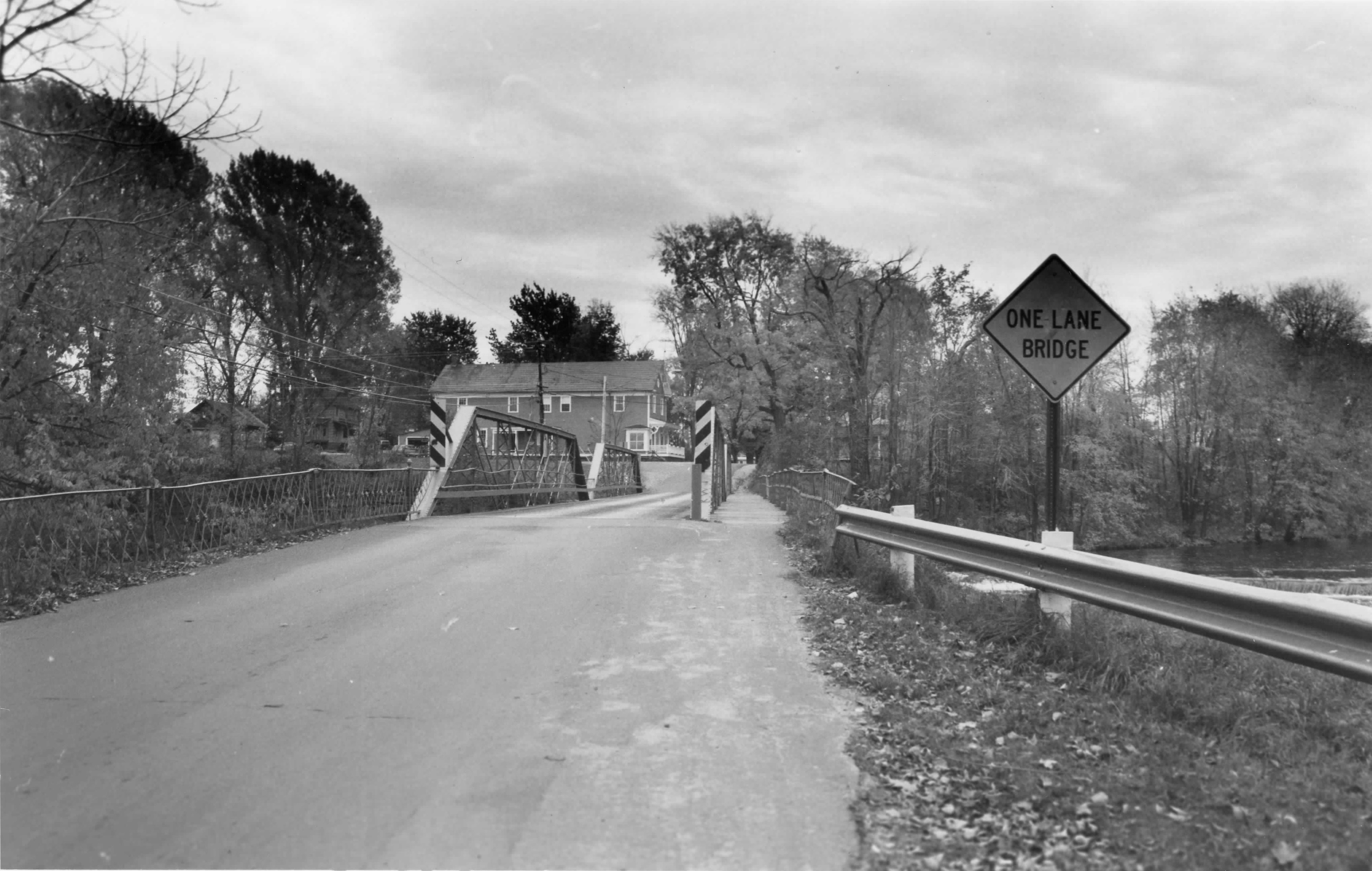
Above: Photo from National Register Nomination showing the bridge prior to alteration.
This bridge is tagged with the following special condition(s): Unorganized Photos
![]()
![]()
![]()
Coordinates (Latitude, Longitude):
Search For Additional Bridge Listings:
Bridgehunter.com: View listed bridges within 0.5 miles (0.8 kilometers) of this bridge.
Bridgehunter.com: View listed bridges within 10 miles (16 kilometers) of this bridge.
Additional Maps:
Google Streetview (If Available)
GeoHack (Additional Links and Coordinates)
Apple Maps (Via DuckDuckGo Search)
Apple Maps (Apple devices only)
Android: Open Location In Your Map or GPS App
Flickr Gallery (Find Nearby Photos)
Wikimedia Commons (Find Nearby Photos)
Directions Via Sygic For Android
Directions Via Sygic For iOS and Android Dolphin Browser
USGS National Map (United States Only)
Historical USGS Topo Maps (United States Only)
Historic Aerials (United States Only)
CalTopo Maps (United States Only)

© Copyright 2003-2024, HistoricBridges.org. All Rights Reserved. Disclaimer: HistoricBridges.org is a volunteer group of private citizens. HistoricBridges.org is NOT a government agency, does not represent or work with any governmental agencies, nor is it in any way associated with any government agency or any non-profit organization. While we strive for accuracy in our factual content, HistoricBridges.org offers no guarantee of accuracy. Information is provided "as is" without warranty of any kind, either expressed or implied. Information could include technical inaccuracies or errors of omission. Opinions and commentary are the opinions of the respective HistoricBridges.org member who made them and do not necessarily represent the views of anyone else, including any outside photographers whose images may appear on the page in which the commentary appears. HistoricBridges.org does not bear any responsibility for any consequences resulting from the use of this or any other HistoricBridges.org information. Owners and users of bridges have the responsibility of correctly following all applicable laws, rules, and regulations, regardless of any HistoricBridges.org information.
![]()