

View Information About HSR Ratings
This bridge includes through truss spans and a deck plate girder span that date to 1913. There also is a series of stone arch approach spans that predate the rest of the bridge and date to the 1850s.
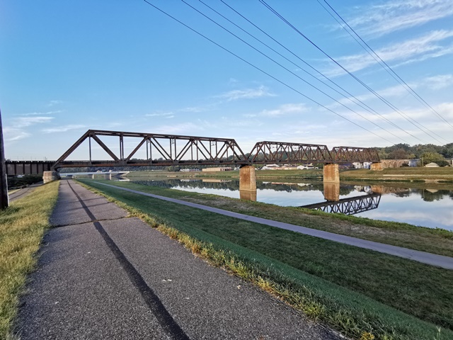
As a riveted three span through truss bridge, this bridge is an impressive bridge in that respect alone. However, the long approach system at the western end of the bridge, a series of over a dozen stone arch spans, is just as significant and impressive as the main truss spans. The eastern end of the bridge also has a deck plate girder approach span.
The truss spans are subdivided Warren through truss spans with riveted connections. There is extensive v-lacing and lattice on the built-up beams on the truss. A deck plate girder span provides an easterly approach to the bridge, and also acts as an overpass over a road. The trusses and plate girder sit on concrete piers and abutments.
Brian Lenihan provided the following information about the bridge: The stone arch viaduct was built in the 1850's and was designed by a local engineer named John Earhard. He later died from disease during the Civil War. The truss bridge was built to replace the previous bridge which was washed away during the 1913 Flood.
Lengths given are estimates.


![]()

![]()
![]()
![]()
![]()
Coordinates (Latitude, Longitude):
Search For Additional Bridge Listings:
Bridgehunter.com: View listed bridges within 0.5 miles (0.8 kilometers) of this bridge.
Bridgehunter.com: View listed bridges within 10 miles (16 kilometers) of this bridge.
Additional Maps:
Google Streetview (If Available)
GeoHack (Additional Links and Coordinates)
Apple Maps (Via DuckDuckGo Search)
Apple Maps (Apple devices only)
Android: Open Location In Your Map or GPS App
Flickr Gallery (Find Nearby Photos)
Wikimedia Commons (Find Nearby Photos)
Directions Via Sygic For Android
Directions Via Sygic For iOS and Android Dolphin Browser
USGS National Map (United States Only)
Historical USGS Topo Maps (United States Only)
Historic Aerials (United States Only)
CalTopo Maps (United States Only)

© Copyright 2003-2024, HistoricBridges.org. All Rights Reserved. Disclaimer: HistoricBridges.org is a volunteer group of private citizens. HistoricBridges.org is NOT a government agency, does not represent or work with any governmental agencies, nor is it in any way associated with any government agency or any non-profit organization. While we strive for accuracy in our factual content, HistoricBridges.org offers no guarantee of accuracy. Information is provided "as is" without warranty of any kind, either expressed or implied. Information could include technical inaccuracies or errors of omission. Opinions and commentary are the opinions of the respective HistoricBridges.org member who made them and do not necessarily represent the views of anyone else, including any outside photographers whose images may appear on the page in which the commentary appears. HistoricBridges.org does not bear any responsibility for any consequences resulting from the use of this or any other HistoricBridges.org information. Owners and users of bridges have the responsibility of correctly following all applicable laws, rules, and regulations, regardless of any HistoricBridges.org information.
![]()