

View Information About HSR Ratings
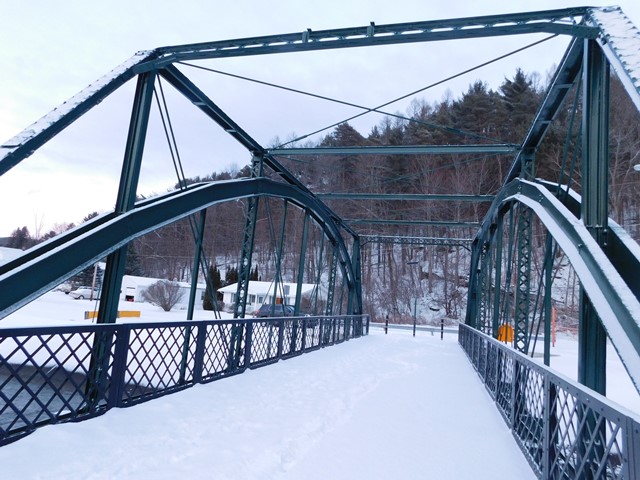
This King Bridge Company through truss was relocated from 7th Street to 4th Street where it replaced a less significant pony truss and was rehabilitated for pedestrians. L.C. Whitford of Wellsville, N.Y. was responsible for the relocation. The bridge's major 1983 alteration of a load-bearing arch which had been added long ago was not removed during relocation.
Information and Findings From Pennsylvania's Historic Bridge InventoryDiscussion of Bridge The one-span, 74'-long, steel thru arch bridge was built in 1983 and fitted into the previous 1883 pin-connected Pratt thru truss bridge, fabricated by the King Iron Bridge Company. The Pratt trusses now merely serve as ornaments that are attached to a modern steel arch superstructure. They have lost their integrity of original design and function. The trusses have no details or features that are not represented by more complete and unaltered examples of similar type and design by the same prolific fabricator. According to PADOT Dist. 2-0, the bridge has been determined eligible by PHMC as a result of Sec. 106 consultation (Note of 5/99). Discussion of Surrounding Area The single lane bridge carries a residential street over the Allegheny River in the borough of Coudersport. The bridge is located in an area with a mix of late-19th to late-20th-century residences. The river is channelized through this area with concrete slopewalls. The setting does not have the cohesiveness or integrity of a potential historic district and it was excluded from the boundaries of the Coudersport Historic District, which is located more than two blocks to the east. Bridge Considered Historic By Survey: Yes |
This bridge is tagged with the following special condition(s): Unorganized Photos
![]()
![]()
![]()
Coordinates (Latitude, Longitude):
Search For Additional Bridge Listings:
Bridgehunter.com: View listed bridges within 0.5 miles (0.8 kilometers) of this bridge.
Bridgehunter.com: View listed bridges within 10 miles (16 kilometers) of this bridge.
Additional Maps:
Google Streetview (If Available)
GeoHack (Additional Links and Coordinates)
Apple Maps (Via DuckDuckGo Search)
Apple Maps (Apple devices only)
Android: Open Location In Your Map or GPS App
Flickr Gallery (Find Nearby Photos)
Wikimedia Commons (Find Nearby Photos)
Directions Via Sygic For Android
Directions Via Sygic For iOS and Android Dolphin Browser
USGS National Map (United States Only)
Historical USGS Topo Maps (United States Only)
Historic Aerials (United States Only)
CalTopo Maps (United States Only)

© Copyright 2003-2024, HistoricBridges.org. All Rights Reserved. Disclaimer: HistoricBridges.org is a volunteer group of private citizens. HistoricBridges.org is NOT a government agency, does not represent or work with any governmental agencies, nor is it in any way associated with any government agency or any non-profit organization. While we strive for accuracy in our factual content, HistoricBridges.org offers no guarantee of accuracy. Information is provided "as is" without warranty of any kind, either expressed or implied. Information could include technical inaccuracies or errors of omission. Opinions and commentary are the opinions of the respective HistoricBridges.org member who made them and do not necessarily represent the views of anyone else, including any outside photographers whose images may appear on the page in which the commentary appears. HistoricBridges.org does not bear any responsibility for any consequences resulting from the use of this or any other HistoricBridges.org information. Owners and users of bridges have the responsibility of correctly following all applicable laws, rules, and regulations, regardless of any HistoricBridges.org information.
![]()