

View Information About HSR Ratings

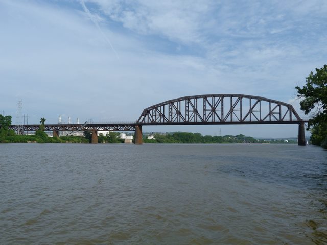
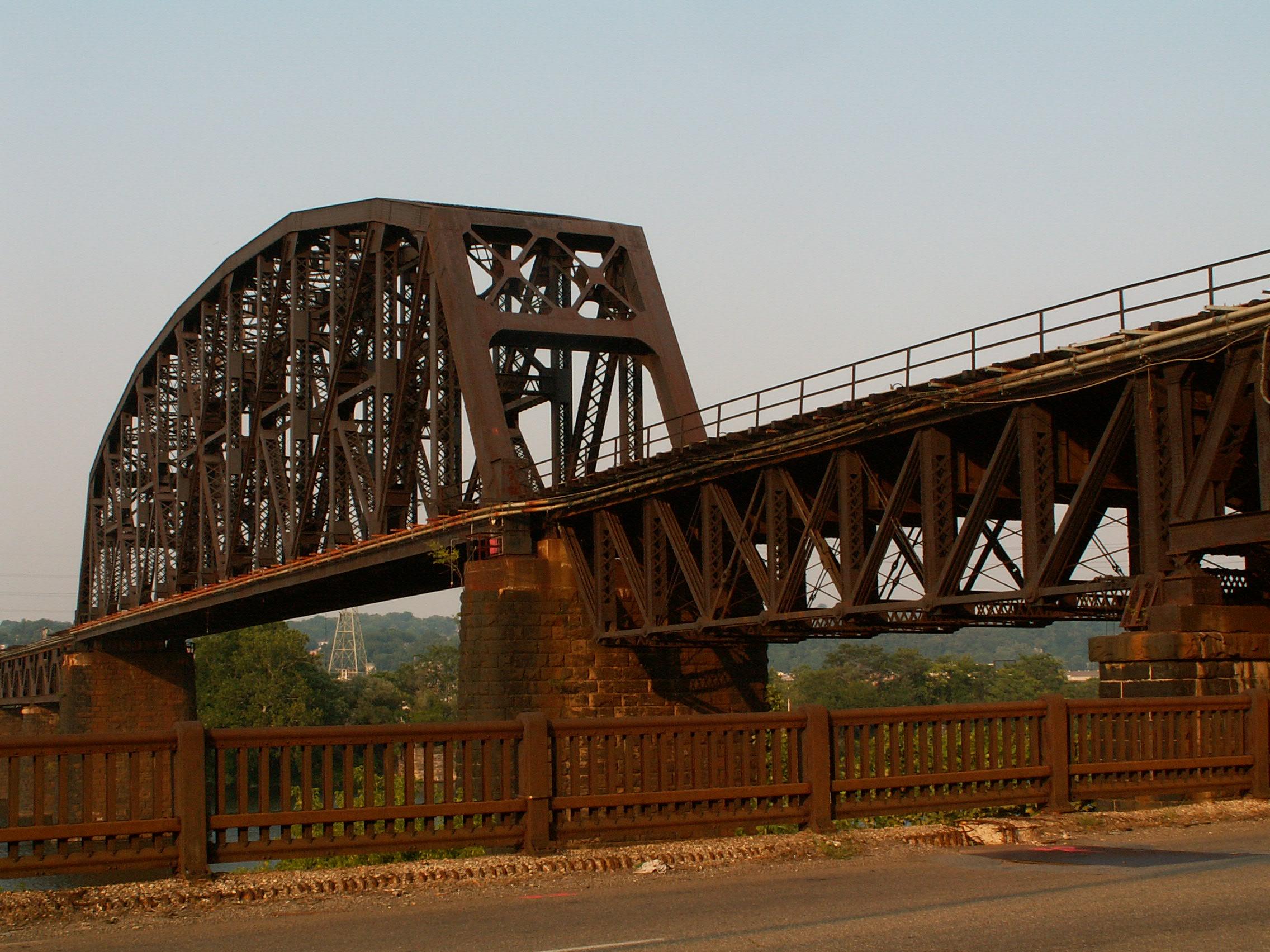
This impressive bridge is very long as uses Brunot Island to cross the Ohio River, and when completed its main channel span was the longest simple truss with riveted connections in the country. The bridge is one single bridge however and does not end on the island, instead crossing it via a series of riveted Warren deck truss spans. The spans over the river's main and back channels are massive riveted Pennsylvania truss spans.

The double-track bridge replaced an 1890 single track bridge. The new double-track bridge used the 1890 piers, which had been designed to support a two-track bridge, evidence of the railroad company thinking ahead to future expansion.
The erection of this bridge's 525 foot main channel is a truly fascinating story. As noted, there are two main through truss spans, separated by a series of deck truss spans. Engineers made use of the materials which would eventually compose the 416 foot back channel span to erect the main channel span. Half of the 416 foot span was erected, using false work at one end, on both ends of the location where the 525 foot span was to be erected. These spans acted as anchor arms, balancing the weight out, so that the 525 foot span could be erected using the cantilever method, which meant building the truss out from each pier, without using falsework to support the bridge. Additional construction materials, such as stringers and floorbeams were piled up on the top of the anchor trusses at the ends to provide for the proper anchor weight. This innovative method allowed for the construction to take place without obstructing the river traffic and having to deal with other inconveniences of falsework, while at the same time, not requiring additional construction materials on site by using parts that were would be needed anyway to compose the rest of the bridge.

Next to each of the main through truss spans is one deck truss span that is a pin-connected Pratt deck truss. These spans differ from the design of the bridge because they are from the original 1890 bridge. For unknown reasons, these spans were originally built as two-track spans, and so they were retained during the reconstruction.

![]()
![]()
![]()
![]()
Coordinates (Latitude, Longitude):
Search For Additional Bridge Listings:
Bridgehunter.com: View listed bridges within 0.5 miles (0.8 kilometers) of this bridge.
Bridgehunter.com: View listed bridges within 10 miles (16 kilometers) of this bridge.
Additional Maps:
Google Streetview (If Available)
GeoHack (Additional Links and Coordinates)
Apple Maps (Via DuckDuckGo Search)
Apple Maps (Apple devices only)
Android: Open Location In Your Map or GPS App
Flickr Gallery (Find Nearby Photos)
Wikimedia Commons (Find Nearby Photos)
Directions Via Sygic For Android
Directions Via Sygic For iOS and Android Dolphin Browser
USGS National Map (United States Only)
Historical USGS Topo Maps (United States Only)
Historic Aerials (United States Only)
CalTopo Maps (United States Only)

© Copyright 2003-2024, HistoricBridges.org. All Rights Reserved. Disclaimer: HistoricBridges.org is a volunteer group of private citizens. HistoricBridges.org is NOT a government agency, does not represent or work with any governmental agencies, nor is it in any way associated with any government agency or any non-profit organization. While we strive for accuracy in our factual content, HistoricBridges.org offers no guarantee of accuracy. Information is provided "as is" without warranty of any kind, either expressed or implied. Information could include technical inaccuracies or errors of omission. Opinions and commentary are the opinions of the respective HistoricBridges.org member who made them and do not necessarily represent the views of anyone else, including any outside photographers whose images may appear on the page in which the commentary appears. HistoricBridges.org does not bear any responsibility for any consequences resulting from the use of this or any other HistoricBridges.org information. Owners and users of bridges have the responsibility of correctly following all applicable laws, rules, and regulations, regardless of any HistoricBridges.org information.
![]()