

View Information About HSR Ratings
2020 Update: This bridge has been rehabilitated.
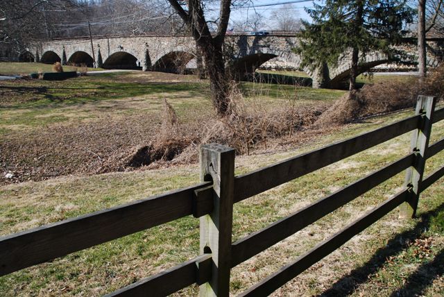
This bridge is one of the longest stone arch bridges in Chester County's impressive collection of stone arch bridges.
Information and Findings From Pennsylvania's Historic Bridge InventoryDiscussion of Bridge The 7-span, 308'-long, stone arch bridge built in 1912 is listed in the National Register. There has been no significant change in the bridge's status since the previous survey. The curved wingwalls at the east end of the bridge have impact damage and show several generations of repointing and repairs. The bridge has voussoirs, fieldstone spandrel walls and parapets with metal pipe hand railings. The arch intrados appear to have been gunited prior to the previous survey. The bridge is a late example of the traditional stone arch bridge technology that continued to be used with great frequency in Chester and other southeastern Pennsylvania counties from the colonial period to about World War I. Discussion of Surrounding Area The bridge carries a 2 lane road over the Brandywine Creek flood plain in a rural setting near Brandywine Picnic Park, a local recreation area, picnic ground, and amusement park. The main bridge over the Brandywine River was placed in 1980 (115005201400561). Bridge Considered Historic By Survey: Yes Information and Findings From Pennsylvania's Stone Arch Bridge Management PlanDiscussion of Bridge This bridge is recommended for long-term preservation. It ranks in the upper third of all stone arch bridges under study in this plan. Most of the bridge is intact, meaning that the cost to rehabilitate the structure is potentially low. The bridge also lies in an area of low development potential, so it should continue to handle its traffic in the future. It has a high values code, as the bridge is listed in the National Register of Historic Places, stands in a park, is part of a greenway, and is on the Brandywine Scenic Byway, a state designated byway. The bridge has received public support (one questionnaire, one letter, and one meeting at which this bridge was the focus). The bridge has a moderate condition code, a result of some loose stones, which could be fixed following the procedures of the Maintenance Manual. It has a moderate transportation code; the bridge is relatively narrow and has an intersection at one end, giving it a poor sight distance on its approach. It also carries a relatively high traffic volume on a narrow deck width. Its waterway is adequate, a result of it crossing only the floodplain (a more recent steel stringer bridge crosses Brandywine Creek). Ratings The Birmingham, Lenape Road Bridge is owned by
PennDOT and is ranked 9th. Recommendation: Recommended for long-term preservation. |
![]()
![]()
![]()
Coordinates (Latitude, Longitude):
Search For Additional Bridge Listings:
Bridgehunter.com: View listed bridges within 0.5 miles (0.8 kilometers) of this bridge.
Bridgehunter.com: View listed bridges within 10 miles (16 kilometers) of this bridge.
Additional Maps:
Google Streetview (If Available)
GeoHack (Additional Links and Coordinates)
Apple Maps (Via DuckDuckGo Search)
Apple Maps (Apple devices only)
Android: Open Location In Your Map or GPS App
Flickr Gallery (Find Nearby Photos)
Wikimedia Commons (Find Nearby Photos)
Directions Via Sygic For Android
Directions Via Sygic For iOS and Android Dolphin Browser
USGS National Map (United States Only)
Historical USGS Topo Maps (United States Only)
Historic Aerials (United States Only)
CalTopo Maps (United States Only)

© Copyright 2003-2024, HistoricBridges.org. All Rights Reserved. Disclaimer: HistoricBridges.org is a volunteer group of private citizens. HistoricBridges.org is NOT a government agency, does not represent or work with any governmental agencies, nor is it in any way associated with any government agency or any non-profit organization. While we strive for accuracy in our factual content, HistoricBridges.org offers no guarantee of accuracy. Information is provided "as is" without warranty of any kind, either expressed or implied. Information could include technical inaccuracies or errors of omission. Opinions and commentary are the opinions of the respective HistoricBridges.org member who made them and do not necessarily represent the views of anyone else, including any outside photographers whose images may appear on the page in which the commentary appears. HistoricBridges.org does not bear any responsibility for any consequences resulting from the use of this or any other HistoricBridges.org information. Owners and users of bridges have the responsibility of correctly following all applicable laws, rules, and regulations, regardless of any HistoricBridges.org information.
![]()