

View Information About HSR Ratings
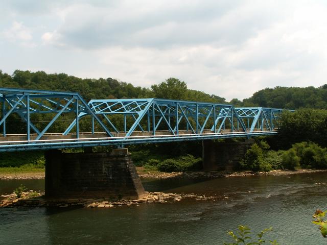
This bridge is an attractive multi-span example of a standard plan truss bridge in Pennsylvania. It is particularly worth a visit because not only it is heavily skewed, it is easy to get the elevation view of the bridge, unlike other bridges of this type, which for whatever reason are often obstructed by trees.
Information and Findings From Pennsylvania's Historic Bridge InventoryDiscussion of Bridge The skewed, 6 span, 704' long bridge consists of 4, riveted, 149' long Pratt thru truss spans over the river and a steel stringer span at each end (1 @ 60', 1 @ 26'). The substructure consists of ashlar abutments and piers with concrete caps. The piers have been repaired with concrete on their upstream side. The upper chord and inclined end posts are built up box sections, and the verticals and diagonals are rolled section. The bridge has no innovative or distinctive details. It was built to a state standard design in 1939 is neither historically nor technologically significant. Riveted truss bridge technology dates to the early 20th century. Discussion of Surrounding Area The bridge carries a 2 lane road over the Kiskiminetas River, providing access into the Allegheny Ludlum (Allegheny Teledyne) Steel Plant that is beyond the northerly end of the bridge in West Leechburg borough. The bridge is not part of the mill, and it is not located in or adjacent to any potential historic district related to the mill or the towns. Bridge Considered Historic By Survey: No |
![]()
![]()
Coordinates (Latitude, Longitude):
Search For Additional Bridge Listings:
Bridgehunter.com: View listed bridges within 0.5 miles (0.8 kilometers) of this bridge.
Bridgehunter.com: View listed bridges within 10 miles (16 kilometers) of this bridge.
Additional Maps:
Google Streetview (If Available)
GeoHack (Additional Links and Coordinates)
Apple Maps (Via DuckDuckGo Search)
Apple Maps (Apple devices only)
Android: Open Location In Your Map or GPS App
Flickr Gallery (Find Nearby Photos)
Wikimedia Commons (Find Nearby Photos)
Directions Via Sygic For Android
Directions Via Sygic For iOS and Android Dolphin Browser
USGS National Map (United States Only)
Historical USGS Topo Maps (United States Only)
Historic Aerials (United States Only)
CalTopo Maps (United States Only)

© Copyright 2003-2024, HistoricBridges.org. All Rights Reserved. Disclaimer: HistoricBridges.org is a volunteer group of private citizens. HistoricBridges.org is NOT a government agency, does not represent or work with any governmental agencies, nor is it in any way associated with any government agency or any non-profit organization. While we strive for accuracy in our factual content, HistoricBridges.org offers no guarantee of accuracy. Information is provided "as is" without warranty of any kind, either expressed or implied. Information could include technical inaccuracies or errors of omission. Opinions and commentary are the opinions of the respective HistoricBridges.org member who made them and do not necessarily represent the views of anyone else, including any outside photographers whose images may appear on the page in which the commentary appears. HistoricBridges.org does not bear any responsibility for any consequences resulting from the use of this or any other HistoricBridges.org information. Owners and users of bridges have the responsibility of correctly following all applicable laws, rules, and regulations, regardless of any HistoricBridges.org information.
![]()