

View Information About HSR Ratings
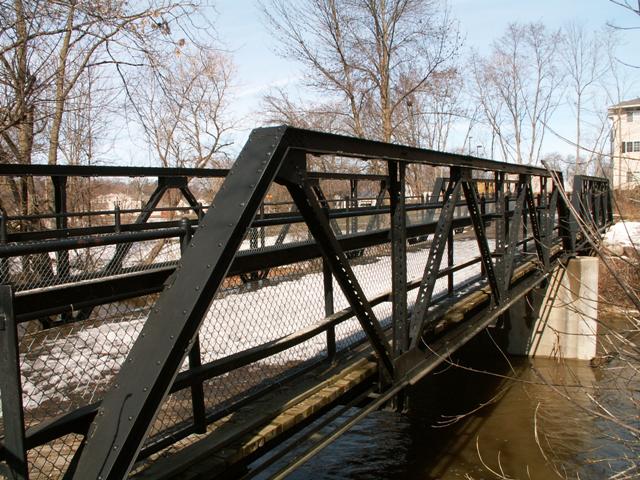
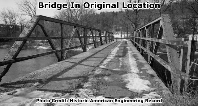
Multi-span pony truss bridges are nearly non-existent in Michigan, so this is a rare bridge due to that alone. This bridge was saved by Portland, as part of a unique Burroughs Street project in which the replacement bridge was the historic Belleville Road Bridge! This brings the total of restored truss bridges in Portland up to three, making them one of the greatest examples of truss bridge preservation in the state! Other cities should see how Portland uses truss bridges to serve a functional purpose and also encourage tourism and bring a general level of beauty and history to the city.
The restoration of the truss bridge itself appears to be done quite well, with no severe alterations noted. Some sections of bottom chord were replaced, but this may date to before restoration. However, the cyclone fencing, which covers over half the height of the trusses themselves seriously reduces the potential beauty of the bridge. Recommended future preservation work for this bridge would be to replace the cyclone fencing with a railing that looks nice (perhaps having a historical appearance), meets current safety needs, yet also minimally blocks the view of the trusses. Many feasible options exist.
This bridge is tagged with the following special condition(s): Reused and Unorganized Photos
![]()
![]()

![]()
![]()
Coordinates (Latitude, Longitude):
Search For Additional Bridge Listings:
Bridgehunter.com: View listed bridges within 0.5 miles (0.8 kilometers) of this bridge.
Bridgehunter.com: View listed bridges within 10 miles (16 kilometers) of this bridge.
Additional Maps:
Google Streetview (If Available)
GeoHack (Additional Links and Coordinates)
Apple Maps (Via DuckDuckGo Search)
Apple Maps (Apple devices only)
Android: Open Location In Your Map or GPS App
Flickr Gallery (Find Nearby Photos)
Wikimedia Commons (Find Nearby Photos)
Directions Via Sygic For Android
Directions Via Sygic For iOS and Android Dolphin Browser
USGS National Map (United States Only)
Historical USGS Topo Maps (United States Only)
Historic Aerials (United States Only)
CalTopo Maps (United States Only)

© Copyright 2003-2024, HistoricBridges.org. All Rights Reserved. Disclaimer: HistoricBridges.org is a volunteer group of private citizens. HistoricBridges.org is NOT a government agency, does not represent or work with any governmental agencies, nor is it in any way associated with any government agency or any non-profit organization. While we strive for accuracy in our factual content, HistoricBridges.org offers no guarantee of accuracy. Information is provided "as is" without warranty of any kind, either expressed or implied. Information could include technical inaccuracies or errors of omission. Opinions and commentary are the opinions of the respective HistoricBridges.org member who made them and do not necessarily represent the views of anyone else, including any outside photographers whose images may appear on the page in which the commentary appears. HistoricBridges.org does not bear any responsibility for any consequences resulting from the use of this or any other HistoricBridges.org information. Owners and users of bridges have the responsibility of correctly following all applicable laws, rules, and regulations, regardless of any HistoricBridges.org information.
![]()