

View Information About HSR Ratings

This bridge is listed on the National Register of Historic Places and was noted by MDOT as one of only a few deck truss bridges of its type on highways in Michigan. A 1935 construction date is given for this bridge. No further commentary was provided. A site inspection of this bridge by HistoricBridges.org revealed that there may be more mystery and story behind this bridge than one might think. First, it is odd for a deck truss to be in this location. Deck truss bridges are more common in areas with steep river valleys, and they tend to be for longer spans as well. This bridge however sits very low; not high off of the river. Also, while granted, this bridge is in a rural location, the 15.7 foot roadway is fairly narrow for a bridge built in 1935. An extremely unusual detail is that although this bridge has riveted connections, a pin, apparently acting as some sort of hinge, is present at the centermost bottom chord connection. The vertical member located at this connection point also has four pairs of empty rivet/bolt holes for an unknown reason. The south end of the top chord has a single pin and a triangular shaped gusset plate. The north end of the top chord has two pins and a square gusset plate. It is possible that this asymmetry is because of an expansion bearing system at one one (closer inspection was not possible during the visit). Either way, this is a somewhat unusual detail. As configured today, the bridge is set up as a trapezoidal truss. The bridge bears on the abutment/pier at the ends of the top chord, while the bottom chord is two panels shorter than the top chord. However, close inspection of the ends of the bottom chord reveals some interesting details. The gusset plates at the ends of the bottom chord are rectangular, where normally triangular gusset plates at this point would be expected. Further, the bottom chord continues to the end of these square gusset plates, which is also not normal. Looking closely at the ends of the bottom chord at this point, it is clear that the bottom chord has been cut. A lacing bar ends abruptly and is not attached to anything, and the rough edges of steel cut by oxy-acetylene torch is visible. It appears that the bottom chord was cut at some point. This leads to a mystery for this bridge. Based on historical practices, the most likely solution to the mystery is that the bridge was reused and relocated to this location. It may have formerly been a highway bridge, or its heavy construction may indicate the former use was for a railroad. The cuts on the bottom chord may indicate that the bridge was shortened when moved here. It may also be that the bridge was originally designed to bear on the bottom chord, as many deck truss bridges do, and that the bridge was converted to bear on the top chord. Finally, if the bridge was relocated, the 1935 date may actually refer to the date it was relocated, not when it was actually built.
This bridge also includes a plate girder approach span. Compared to the many unusual details of the truss bridge, the plate girder span is quite typical in construction. It likely came from the same place as the truss span originated from. It is somewhat unusual in that there are no steel floor beams, and the wooden base deck appears to bear on lateral bracing that runs between the girders as well as tiny transverse wooden beams.
The bridge has unusual lattice "hub guard" style railings. These also are an unusual detail for a 1935 bridge, but it is not known if they were installed in 1935, or if they came with the bridge from a previous location, or if they might have been salvaged from a completely different bridge. They are however unusual due to the tall "x's" in the lattice, different from the square "x" pattern used in traditional hub guard railing. Sadly, a lot of this railing has been damaged and destroyed.
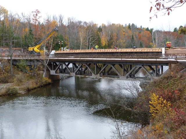
In 2012, a new bridge was built just west of the historic bridge. Fortunately, the historic bridge is to be left standing next to its replacement, according to the contract, and will not be demolished. Marquette County deserves to be thanked for making a decision of preservation. The historic bridge is currently in good condition, and will likely stand for decades in this condition even without repairs.
![]()
![]()
![]()
Coordinates (Latitude, Longitude):
Search For Additional Bridge Listings:
Bridgehunter.com: View listed bridges within 0.5 miles (0.8 kilometers) of this bridge.
Bridgehunter.com: View listed bridges within 10 miles (16 kilometers) of this bridge.
Additional Maps:
Google Streetview (If Available)
GeoHack (Additional Links and Coordinates)
Apple Maps (Via DuckDuckGo Search)
Apple Maps (Apple devices only)
Android: Open Location In Your Map or GPS App
Flickr Gallery (Find Nearby Photos)
Wikimedia Commons (Find Nearby Photos)
Directions Via Sygic For Android
Directions Via Sygic For iOS and Android Dolphin Browser
USGS National Map (United States Only)
Historical USGS Topo Maps (United States Only)
Historic Aerials (United States Only)
CalTopo Maps (United States Only)

© Copyright 2003-2024, HistoricBridges.org. All Rights Reserved. Disclaimer: HistoricBridges.org is a volunteer group of private citizens. HistoricBridges.org is NOT a government agency, does not represent or work with any governmental agencies, nor is it in any way associated with any government agency or any non-profit organization. While we strive for accuracy in our factual content, HistoricBridges.org offers no guarantee of accuracy. Information is provided "as is" without warranty of any kind, either expressed or implied. Information could include technical inaccuracies or errors of omission. Opinions and commentary are the opinions of the respective HistoricBridges.org member who made them and do not necessarily represent the views of anyone else, including any outside photographers whose images may appear on the page in which the commentary appears. HistoricBridges.org does not bear any responsibility for any consequences resulting from the use of this or any other HistoricBridges.org information. Owners and users of bridges have the responsibility of correctly following all applicable laws, rules, and regulations, regardless of any HistoricBridges.org information.
![]()