

View Information About HSR Ratings
This is a very old railroad swing bridge that replaced a movable wooden structure that dated to 1869. Some sources indicate that the existing bridge has an 1893 construction date. However, the stone piers of this bridge suggest a different possibility. Many of the stones of the substructure have graffiti from people carving useless junk into them over the years. However, one carving stuck out as something that might not be graffiti. A stone block on a northern pier appears to have been sculpted to produce a raised square section on the stone. Within this stone the text L H u D. OCT. 21 1894 is visible. This may be the initials of the stone mason and the date of their construction. However, the substructure would have to be the first part of the bridge built, so assuming this date is a real mark from the masons who built the pier (and not some unusual modern graffiti) the bridge would have to date to 1894, and perhaps not even completed until 1895. The unusual stone is shown below. To the left is the raised portion of stone with the writing in question. To the right is an example of typical graffiti markings on the stones.

This swing bridge ceased to swing in 1907 when boats stopped traveling the Grand River. The bridge carried trains up until 1975. The bridge was designed to carry a single set of tracks. Today the bridge has been converted for use as part of a rail-trail.
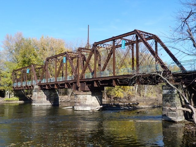
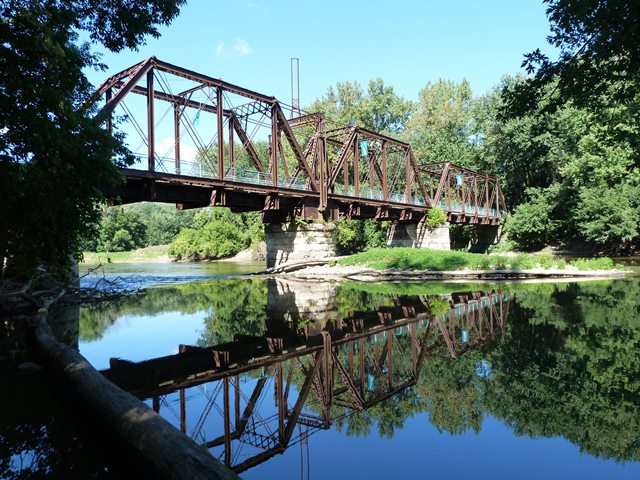
The existing bridge totals approximately 550 feet, and is composed of three 100 foot through truss spans, plus one 138 foot through truss swing span. A single deck plate girder span provides an approach at the southern end. The northern end has three short steel stringer spans supported by timber bents. Before the bridge was converted to a rail-trail bridge, a structurally independent 400 foot timber trestle structure provided a curved approach north of the bridge. Much of this wooden structure still stood in 2006, but was disconnected from the truss bridge, while the trail made a T intersection with another trail perpendicular to the bridge. By 2011, the 400 foot trestle was demolished and replaced with a modern timber trestle to carry an extension of the rail-trail. Following this rail-trail north from the bridge, more insight into the history of this railroad line is revealed. A short distance north of the bridge, the mainline continues to curve eastward, and at this curve, an old abandoned branch of the railroad line breaks off to head northward and crosses a small creek on a steel stringer structure supported by timber bents. The stringer bridge has United States Steel marks on it and bolted design suggested it may be from the mid-20th Century... certainly not as old as the swing bridge. The purpose of this old branch is unclear, and it is today extremely overgrown and the land where this branch would have gone is blocked by a large man-made hill, possibly part of a gravel pit. Meanwhile, the main railroad line, today the rail-trail, continues past the abandoned branch and also crosses the small creek on its own wooden structure.
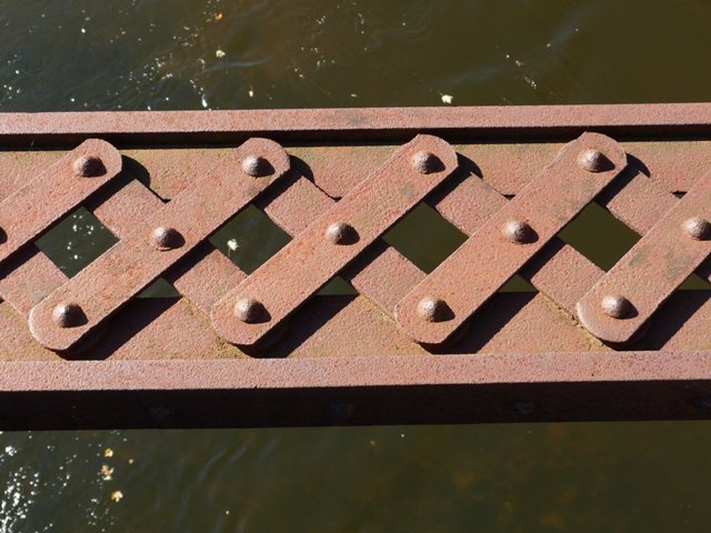
The truss spans are all pin connected, and their many built-up beams are extensively latticed and v-laced. The swing span even features v-lacing on the top of the top chord and end post (instead of more common cover plate), and the fixed truss spans similarly feature lattice on the top of the top chord and end posts. Both of these characteristics are highly uncommon, in spite of the fact that the nearby Grand Rapids Swing Bridge has v-lacing on top of its top chord as well. One extremely unusual feature is the bottom chord of the fixed truss spans. The first couple panels of these spans have a bottom chord design that includes paired eyebars, but in a most unusual design, each eyebar is riveted to an angle. The two angles are connected by lattice. Riveting angles to eyebar is highly unusual, as is connecting the two eyebars with lattice.
This bridge remains in outstanding physical condition, especially the metal of the trusses which show little to no deterioration.
Unlike most historic bridges on rail-trails, there actually is some interpretive signage discussing this bridge, which is nice to see. Less impressive is the ugly cyclone fencing that was placed to function as a railing on the bridge. It would be nice to see this replaced with a metal railing of more dignified appearance that additionally does not visually obstruct the view of the bridge's trusses in the way that the cyclone fencing does.
This bridge is tagged with the following special condition(s): Unorganized Photos
![]()
![]()
![]()
![]()
![]()
![]()
![]()
Coordinates (Latitude, Longitude):
Search For Additional Bridge Listings:
Bridgehunter.com: View listed bridges within 0.5 miles (0.8 kilometers) of this bridge.
Bridgehunter.com: View listed bridges within 10 miles (16 kilometers) of this bridge.
Additional Maps:
Google Streetview (If Available)
GeoHack (Additional Links and Coordinates)
Apple Maps (Via DuckDuckGo Search)
Apple Maps (Apple devices only)
Android: Open Location In Your Map or GPS App
Flickr Gallery (Find Nearby Photos)
Wikimedia Commons (Find Nearby Photos)
Directions Via Sygic For Android
Directions Via Sygic For iOS and Android Dolphin Browser
USGS National Map (United States Only)
Historical USGS Topo Maps (United States Only)
Historic Aerials (United States Only)
CalTopo Maps (United States Only)

© Copyright 2003-2024, HistoricBridges.org. All Rights Reserved. Disclaimer: HistoricBridges.org is a volunteer group of private citizens. HistoricBridges.org is NOT a government agency, does not represent or work with any governmental agencies, nor is it in any way associated with any government agency or any non-profit organization. While we strive for accuracy in our factual content, HistoricBridges.org offers no guarantee of accuracy. Information is provided "as is" without warranty of any kind, either expressed or implied. Information could include technical inaccuracies or errors of omission. Opinions and commentary are the opinions of the respective HistoricBridges.org member who made them and do not necessarily represent the views of anyone else, including any outside photographers whose images may appear on the page in which the commentary appears. HistoricBridges.org does not bear any responsibility for any consequences resulting from the use of this or any other HistoricBridges.org information. Owners and users of bridges have the responsibility of correctly following all applicable laws, rules, and regulations, regardless of any HistoricBridges.org information.
![]()