

View Information About HSR Ratings
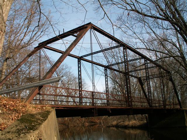
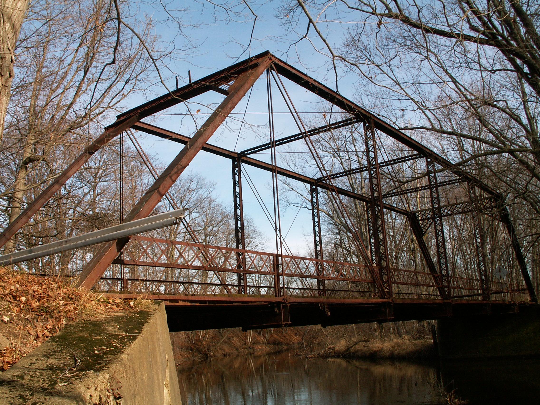
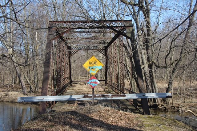
This bridge retains remarkable historic integrity, and although closed to traffic, is in decent structural condition. It is an excellent example of a classic pin-connected Pratt through truss. Retaining its lattice guardrails and wooden deck, the only thing this bridge lacks is its builder plaque. This bridge is nearly identical to a number of bridges constructed in Iroquois County, Illinois. Iroquois County is noted for doing business with the Massillon Bridge Company of Massillon, Ohio. It is quite possible, that the Mead Road Bridge was built by them as well. The bridge appears to have been closed to traffic for quite some time. Little trace of the road is left leading eastward from the bridge. The bridge is composed of six panels. The bridge has v-lacing on vertical members, sway bracing, and under the upper chord. The portal bracing is a lattice design. The guardrails are also a lattice design, composed of a single row of lattice between two angles. The bridge sits on concrete abutments. The abutments are in overall fair condition, although there is an area of cracking/erosion that will likely become a problem in future years if it expands. It would be tragic for this bridge to end up like the Maple Rapids Road Bridge. The metal on the bridge is rusted, leaving no trace of paint, but has not eroded much. This is a bridge that could and should be restored, either here or in another location.
This bridge is tagged with the following special condition(s): Available and Unorganized Photos
![]()
![]()
![]()
![]()
Coordinates (Latitude, Longitude):
Search For Additional Bridge Listings:
Bridgehunter.com: View listed bridges within 0.5 miles (0.8 kilometers) of this bridge.
Bridgehunter.com: View listed bridges within 10 miles (16 kilometers) of this bridge.
Additional Maps:
Google Streetview (If Available)
GeoHack (Additional Links and Coordinates)
Apple Maps (Via DuckDuckGo Search)
Apple Maps (Apple devices only)
Android: Open Location In Your Map or GPS App
Flickr Gallery (Find Nearby Photos)
Wikimedia Commons (Find Nearby Photos)
Directions Via Sygic For Android
Directions Via Sygic For iOS and Android Dolphin Browser
USGS National Map (United States Only)
Historical USGS Topo Maps (United States Only)
Historic Aerials (United States Only)
CalTopo Maps (United States Only)

© Copyright 2003-2024, HistoricBridges.org. All Rights Reserved. Disclaimer: HistoricBridges.org is a volunteer group of private citizens. HistoricBridges.org is NOT a government agency, does not represent or work with any governmental agencies, nor is it in any way associated with any government agency or any non-profit organization. While we strive for accuracy in our factual content, HistoricBridges.org offers no guarantee of accuracy. Information is provided "as is" without warranty of any kind, either expressed or implied. Information could include technical inaccuracies or errors of omission. Opinions and commentary are the opinions of the respective HistoricBridges.org member who made them and do not necessarily represent the views of anyone else, including any outside photographers whose images may appear on the page in which the commentary appears. HistoricBridges.org does not bear any responsibility for any consequences resulting from the use of this or any other HistoricBridges.org information. Owners and users of bridges have the responsibility of correctly following all applicable laws, rules, and regulations, regardless of any HistoricBridges.org information.
![]()