


View Information About HSR Ratings

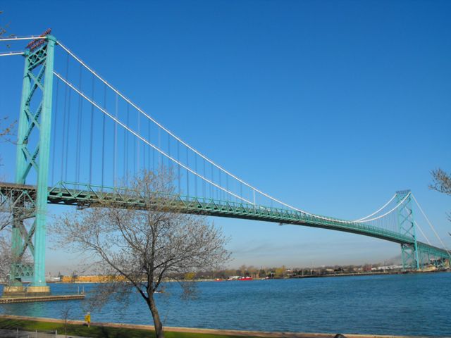
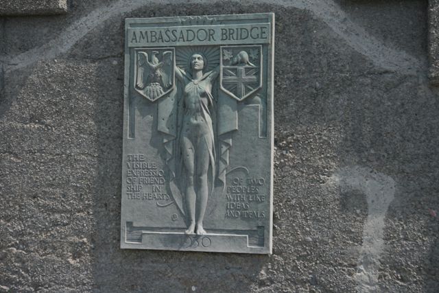
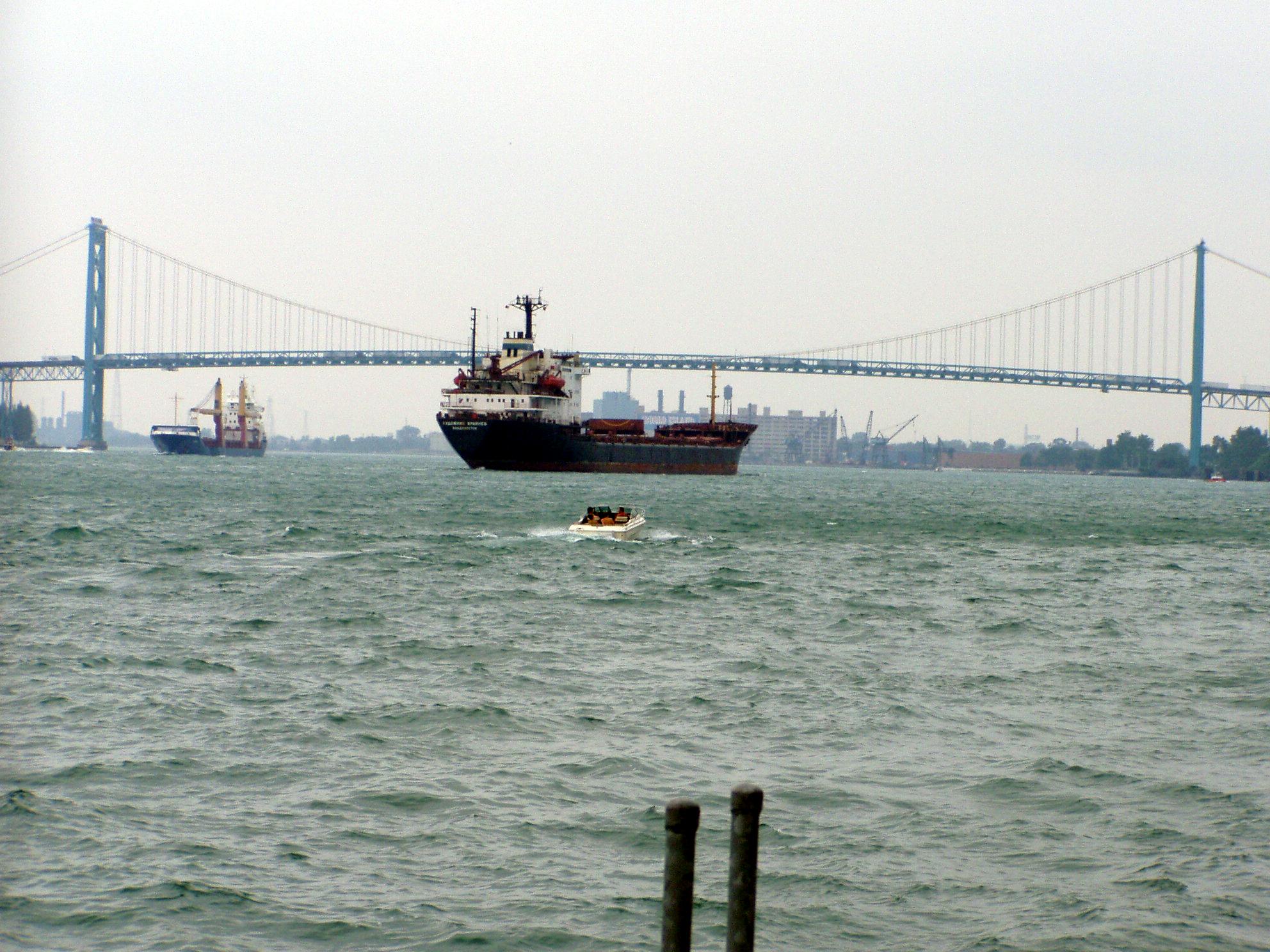
Michigan has had the distinction of having twice built the longest suspension bridge in the world. The Ambassador Bridge, constructed in 1929, was the first, and the Mackinac Bridge was the second.

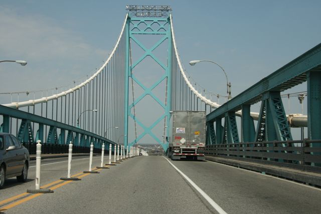
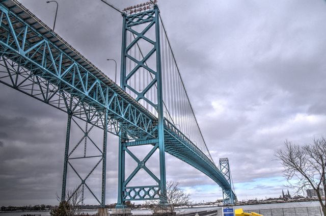
The bridge is unusual because the section of bridge between the anchorages and the main towers is not suspended. The main cables run directly down and into the enormous concrete anchorages for the bridge. Note the lack of suspender cables in this section. This section is instead supported by a system of deck truss spans. The bridge members and towers are painted an attractive aquamarine color, while the cables are white. The bridge was originally painted black for many years. The towers feature a heavy lattice design, and feature the name of the bridge mounted on top of them.
The bridge features an attractive Warren pony truss stiffening system for the main suspended span. Deck plate girder spans provide for most of the approach system, except between the anchorages and the towers, and also a span over Fort Street in Detroit, which are all Warren deck truss spans. and deck truss spans provide an approach. The approach spans include steel bent supports of varying designs.
Finally, another unusual thing to note is that the bridge is privately owned and operated by the Detroit International Bridge Company. Neither MDOT nor the MTO own the bridge. Wayne County, MI has another independently owned bridge, which is the Grosse Ile Toll Bridge.
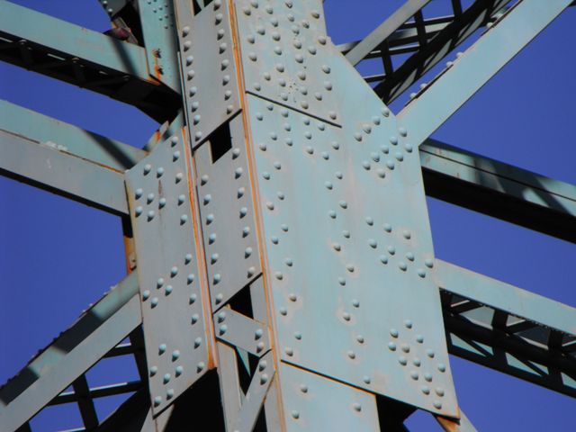
The Ambassador Bridge appears to have been well maintained overall, despite reports that the bridge is in need of repair. Recently the bridge was in the news because Detroit International Bridge Company was forced to release a bridge inspection report to the public. The report mentions that some repairs are indeed need, but overall, the bridge is in decent shape. Section loss that had started to develop on the bridge was halted by application of paint. Very little rust was observed on the bridge during the 2010 documentation of the bridge.
Historic integrity of the bridge also appears to be good, with very few major alterations to the superstructure or substructure noted. For a bridge that carries the volume of traffic that the Ambassador Bridge does, this is very noteworthy, and it adds to the extremely high level of historic significance of the structure.
The bridge seen today is far more streamlined and graceful than one of the original proposals for a bridge at this location. Consider the below drawing which outlines an early proposal for a Detroit-Windsor Bridge. The prosed design is far more bulky in appearance, with four main cables instead of two and heavier tower design. The design also had finials on top of the bridge.

The current plan of the Detroit International Bridge Company is to construct a modern cable-stayed bridge next to the existing historic bridge. However, this plan has been met with strong opposition from a wide variety of people and agencies on both sides of the border. The overly confident Detroit International Bridge Company actually built an approach to the replacement bridge on the Detroit side as far as permits would allow, and had to stop construction when they could not get the clearance and permits needed for the main spans. Currently, the approach abruptly ends right at Fort Street. The Detroit International Bridge Company currently uses this approach system to access the historic bridge with the revised toll plaza currently in use.

Likely nearly all modern large river crossings, the proposed replacement bridge is a cable-stayed bridge. Like all modern cable-stayed bridges, the proposed bridge is a plain, ugly, and unremarkable bridge that is similar in appearance to most modern cable-stayed bridges. The construction of this new bridge will have a strongly adverse affect on the visual qualities of the crossing. The Environmental Assessment for the project uses a part of the Secretary of the Interior's Standards for Rehabilitation that states that new construction should not be made to replicate the existing historic structure to justify construction of the cable-stayed bridge. However, this interpretation defeats the spirit of those standards, which is the maintain the qualities of a historic structure. While the cable-stayed bridge certainly doesn't replicate the historic bridge, it does overwhelm and obstruct the clean and pleasing view of the historic bridge. Indeed, the ridiculous height of the cable-stayed bridge's towers dwarf the historic bridge, destroying the ability to look at the historic bridge and imagine that the bridge was the longest suspension bridge in the world when built. What would have been a better solution? Design a modern suspension bridge for this crossing whose deck and cables would follow the exact profile of the historic bridge. Such a bridge would still meet Secretary of the Interior's Standards for Rehabilitation, since the new bridge would still not even come close to being a replica of the historic bridge. Such a new bridge would still be ugly, and would have far more concrete in its design, lack built-up steel beams with attractive v-lacing and lattice, and would be wider. However having a matching profile would not disrupt the existing appearance of the crossing as much.
Perhaps the most initially alarming aspect of the replacement project is that it is a replacement project, rather than a project to add a second bridge to form a one-way couplet of bridges as was done with the Blue Water Bridge. Indeed, the proposed project is to completely replace the historic Ambassador Bridge with a two-lane bridge. This is alarming because it would appear that the bridge would not be serving any real purpose. Thus, this could put the bridge at risk for demolition by the Detroit International Bridge Company. Further, the U.S. Coast Guard has the authority to condemn any bridge that it determines is not serving the function of a bridge. To help mitigate this risk, the Michigan SHPO and the Advisory Council on Historic Preservation (ACHP) both advocated the inclusion of a "maintenance condition" that would be included in the Section 106 Memorandum of Agreement (MOA) that would require the historic bridge to be preserved. HistoricBridges.org strongly supports this requirement. Further, HistoricBridges.org suggests that the historic Ambassador Bridge be used as a crossing for non-motorized traffic, another option considered in the Section 106 discussions.

The Detroit International Bridge Company is strongly against government plans to construct another cable-stayed bridge... this one publically owned... downstream of the historic Ambassador Bridge near the Delray area of Detroit. This proposed bridge would simulate the convenience of the Blue Water Bridge by providing a direct limited access highway connection between I-94/I-75 in Detroit and KH-401 in Windsor. The historic Ambassador bridge in contrast is not directly connected to KH-401 and instead drivers must access the bridge via a six lane surface road with many stoplights. Thus it is not hard to understand why the Detroit International Bridge Company does not want this new bridge to be built downstream, since many people would use this convenient crossing and the profits of the Detroit International Bridge Company would drop.
Profit margins and private interests set aside however, the most sensible plan would be to build this new crossing in Delray and not build the new cable-stayed bridge next to the Ambassador Bridge. The new bridge downstream would relieve traffic on the Ambassador Bridge such that the historic bridge alone was sufficient for that crossing, and the new bridge downstream would be far enough away so as to not ruin the view of the historic Ambassador bridge.
The Ambassador Bridge had a sidewalk on it. However, following the September 11th attacks, the sidewalk was closed due to security concerns. It is most unfortunate that authorities allowed these evil terrorist attacks to succeed in their goal of reducing freedom, creating fear, and adversely affecting the operation of life and government in North America. By disallowing pedestrians on the bridge, authorities have proven that terrorism works, since the closure of the bridge sidewalk represents a loss of freedom and the pursuit of happiness, which are the democratic ideals that the terrorists wish to destroy. Further, the closing of the sidewalk also increases pollution and reduces healthy behavior by forcing people to drive across the bridge rather than walk or ride a bicycle. A possible security solution would be to screen pedestrians prior to crossing the bridge. In truth, this might not be a bad idea for motor vehicles as well, since under the current system, the customs inspections only occur after a vehicle has crossed the bridge.
This bridge may span between Detroit, Michigan and Windsor, Ontario, but this bridge is truly Windsor's bridge. A well-maintained and extensive park and river-walk exists east of the bridge and from this location absolutely spectacular and unobstructed views of the bridge can be had. A city street also runs parallel to the approach spans of the bridge offering excellent views of the approach system.
In contrast, photographing the bridge is nearly impossible in Detroit, since the bridge is surrounded by private property and razor wire cyclone fence. The only riverside park near the bridge is extremely small and was shrunk even more when Detroit International Bridge Company bought up some of the land. In addition, HistoricBridges.org has read reports of photographers in this park being harassed by Detroit International Bridge Company security guards (who patrol the lands bought up by the Detroit International Bridge Company around the bridge) even if the photographer is on public property, such as in the riverside park, and thus not in violation of any law.
Anyone wishing to visit the Ambassador Bridge is strongly recommended to do so from the Windsor side. The Detroit side is not even remotely worth the trouble.
Be sure to view the photo gallery of this bridge, where you will find a beautiful set of overview photos from Windsor, and a comprehensive set of detail photos. Despite the lack of a sidewalk, HistoricBridges.org is also proud to present a collection of high quality photos taken from inside a car using a clean windshield and a high speed DSLR camera. In short, this is the largest single collection of Ambassador Bridge photos on the Internet.
Information and Findings From MDOT
The Ambassador Bridge connects the United States and Canada by spanning
the Detroit River. It is one of only two suspension bridges built in
Michigan and at the time it was completed, was the longest suspension
bridge in the world, extending a total of 9,602 feet with approaches.
Construction began on May 7, 1927 and was well on its way when it was
discovered that there was considerable breaking of the cable wires in
the Mount Hope suspension bridge in Rhode Island, where the
McClintic-Marshall Company was using the same heat-treated wires that
the design for the Ambassador Bridge called for. Work on the Ambassador
Bridge was suspended on March 5, 1929 and it was decided to replace all
of the heat-treated wire with cold drawn wire. This was a major
endeavor, since the main cables were already in place and much of the
center span had already been completed, including the stiffening
trusses. The main span was dismantled by lowering the stiffening
trusses, floor beams, and suspended steel onto barges in the river. The
new cables were then erected, and finally, the suspended span steel was
replaced. The bridge was opened to traffic on November 15, 1929, nine
months ahead of its scheduled opening despite these modifications. |


This bridge is tagged with the following special condition(s): Unorganized Photos
![]()
![]()
![]()
![]()
![]()
![]()
![]()
![]()
![]()
![]()
![]()
![]()
Coordinates (Latitude, Longitude):
Search For Additional Bridge Listings:
Additional Maps:
Google Streetview (If Available)
GeoHack (Additional Links and Coordinates)
Apple Maps (Via DuckDuckGo Search)
Apple Maps (Apple devices only)
Android: Open Location In Your Map or GPS App
Flickr Gallery (Find Nearby Photos)
Wikimedia Commons (Find Nearby Photos)
Directions Via Sygic For Android
Directions Via Sygic For iOS and Android Dolphin Browser

© Copyright 2003-2024, HistoricBridges.org. All Rights Reserved. Disclaimer: HistoricBridges.org is a volunteer group of private citizens. HistoricBridges.org is NOT a government agency, does not represent or work with any governmental agencies, nor is it in any way associated with any government agency or any non-profit organization. While we strive for accuracy in our factual content, HistoricBridges.org offers no guarantee of accuracy. Information is provided "as is" without warranty of any kind, either expressed or implied. Information could include technical inaccuracies or errors of omission. Opinions and commentary are the opinions of the respective HistoricBridges.org member who made them and do not necessarily represent the views of anyone else, including any outside photographers whose images may appear on the page in which the commentary appears. HistoricBridges.org does not bear any responsibility for any consequences resulting from the use of this or any other HistoricBridges.org information. Owners and users of bridges have the responsibility of correctly following all applicable laws, rules, and regulations, regardless of any HistoricBridges.org information.
![]()